Thursday, April 26, 2012

The Alaska Highway - ALCAN


The New Alaska Highway. View as you approach Haynes Junction.

When it was first constructed in 1942, the Alaska Highway (once known as the Alcan) was a slow, gravel road, intended for military convoys and supply trucks. Roadhouses and service stations were few and far between. The Alaska Highway was finally opened to the public in 1948. When the highway was originally built it was about 1,700 miles long. It took an army of workers about 7 months to complete the construction. Due to re-construction and straightening of the road, the Alaska Highway now covers a distance of 1,387 miles. 

Old truck left abandoned on the side of the old Alaska Highway road. This section is mainly gravel.
 Back in those days,  travelers needed to carry extra gas cans, two or more spare tires, and survival gear. Various screens and panels were used to protect headlights and windshields from destruction by flying gravel thrown up by passing trucks. Personal vehicles ready for an Alaska journey often resembled a cross between an armored personnel carrier and the Beverly Hillbillies’ truck.

Section of the old roadbed.
 Today, the primary route to Alaska is all but completely paved. Nowhere will you have to go more than a hundred miles between fueling points. On many segments, tight curves have been smoothed, straightened and lanes have been widened. Today there is plenty of  traffic on this road with good-hearted people that your chances of getting stranded are slim. I stopped along the side of the road to change lenses on my camera and immediately someone stopped and asked if I was OK. For a long time, the Alaska Highway was the only driving route to Alaska. Today it is possible to drive to Anchorage almost completely via alternate and equally wonderful routes, all of which offer plenty of scenic beauty and long miles.

With all the improvements on this road and services along the way, the drive to Alaska should not be taken lightly. The miles are long and are still quite empty. The Milepost Magazine suggests carrying two spare tires (or at least a can of a fix-a-flat product) and a 5-gallon gas can. A wondering moose can still walk onto the road and end your trip really quick. One the biggest consideration is the amount of time it takes to reach Anchorage. About four long days from Seattle is the norm, or 10 days for me from the East coast. If you plan to drive round trip, you’ll want to allot at least three to four weeks for the entire journey.

Old roadbed. Notice trees and shrubs growing on the roadway.
  On my way up to Anchorage I had to do some exploring of my own along this highway. As I drove the Alaska Highway today, I saw the old road alongside the new road on my way to Haynes Junction. After careful observation, I noticed that the old roadbed crossed the new highway along many sections numerous times. This prompted me to get out and explore. I drove off the side of the road and met up with the old highway. I was not completely sure whether the road was OK to drive on but I continued on. I was amazed at what I found. The old road was overgrown with trees and in many places along the road the forest had encroached onto the road so much that the path was just wide enough for my vehicle to get through. I drove about 5 miles on the old highway and even found an old vehicle left abandoned from the old days. My mind keep thinking what is was like driving the ALCAN back then.

The old forgotten road.
I would like to offer a word of warning here. This road is very rough, way off the beaten path and away from the main road system, so if you venture out here do so with with extreme caution. Know your vehicle and its limitations. A high clearance vehicle is recommended. If you encounter an issue out here  you could be in serious trouble. In many places the road was completely eroded and  badly washed out. My 2 wheel drive van managed to traverse this 5 mile section without a problem. For me, I was glad I made the choice to venture out and explore this old road as part of my adventure to Alaska!

The video below is a short clip of what it was like driving the original Alaska highway.


Tuesday, April 24, 2012

The Last Wild Road to Alaska

The Stewart-Cassiar Highway (BC37) 


The Cassiar (Highway 37 North) traverses through some of the most remote and beautiful scenery in British Columbia. It is one of only two land routes to the State of Alaska and has few sparsely populated areas along the way. The total distance from the junction of Highway 16 to the Yukon border is about 450 miles. Wild rivers, deep canyons, magnificent mountains, clear lakes and pristine areas makes this area very unique. The road north starts in the town of Kitwanga on the Skeena River and travels north to connect with the Alaska Highway (97) near Watson Lake.

St. Paul's Anglican Church (1893) in Kitwanga. To the right is the original bell tower. This church is over 100 years old.

 This route has been upgraded in through the years and now is completely hard surfaced except for some sections of gravel on either side of the Stikine River Bridge. This road is suitable for all types of vehicles.


This lone wolf crossed the road in front of me.
The Cassiar Highway (BC Highway 37) runs west of the Skeena Mountains and east of the Coast Range, connecting the great northwestern rain forest with the spruce forests of the Yukon. At Dease Lake the highway crosses the continent’s other great divide, where the waters stop flowing west into the misty rainforests of the Pacific Ocean and flow instead north through pine forests ending up in the deltas of the treeless Arctic. A short walk from the roadside brings you to the unspoiled wilderness that is the home for wolf, moose, fox, lynx, black and grizzly bears just to name a few.

Black Bear showing me his best side. Cassiar Highway
Red Fox
In 2009, I drove north on the Cassiar on my way to Alaska while transporting one of our Planet Earth Adventures vehicles.  The scenery back then was amazing! Now the highway is taking a different look and one that I am not particularly happy about. All along the Cassiar, large swaths of trees have been cut down to make room for what appears to be a road-widening project. In some areas, very large and wide clearings have been clear-cut through the spruce forest as if to re-route the road. Huge fires and smoke billows from the clear cut areas as workers burn the trees that have been taken down. I have been researching the Internet but have not been able to find any information as to what is happening here. I hope that I am wrong, but this project will forever change the allure of what makes this road unique. 

Lynx
During my road-trip I have been asked by many friends as to which road I would take to Alaska, the ALCAN or the Cassiar. For me, I have always been attracted to the Cassiar Highway because of its remoteness and wild feel. A good friend of mine, Helen said it best, “I've opted for the Cassiar almost every time simply because it's wilder and more to my liking” The same feelings hold true for me. It is the road less traveled, at least until now. This road has never let me down when it comes to wildlife sightings. Almost immediately upon entering the highway today, I saw so many black bears that I lost count! Along this road, it is not uncommon to see wildlife crossing and walking the road. When this project is completed I wonder what it will be like. Soon, it appears that it will be a 4-lane highway. Most of the wood surfaced bridges will be replaced by concrete & steel bridges. The road will probably be crowded with speeding cars, 18-wheelers and RV's. At least I’ve had the opportunity in my lifetime to experience this amazing road the way it was!

Today’s roadtrip along the Cassiar Highway has been bittersweet for me, as I know the next time I drive though here this awesome road will not have the same look & feel. 

Clear cutting work being done along the Cassiar Highway

Monday, April 23, 2012

Week One - Into Prince George, British Columbia

Well it has been one week already with 7 days of solid driving. I've been driving almost 10 - 12 hours per day and have covered about 3,300 miles so far and have just about 1,800 more miles to go.


Spent 3 gorgeous days exploring the Olympic Peninsula and the city of Seattle, WA. I could have not asked for better weather. Some small showers but sunshine for the most part of my stay in the Seattle area. My visit to the Olympic Peninsula took me to Port Townsend; the Dungeness National Wildlife Refuge; Port Angeles; La Push; Rialto Beach and the Hoh Rain Forest.

At Port Townsend, I visited the lighthouse at Point Wilson. First established in 1879, the light was originally on top of the lighthouse keeper's house. The name of the light and the point it stands on comes from Captain George Vancouver, who first sighted the point in May of 1792. In 1913 the present distinctive structure was built. The fixed white light with a red flash every 20 seconds comes from a 1000 watt bulb through a rotating fourth-order Fresnel lens. The light has a range of sixteen miles. Before electricity, the light was produced by an oil lamp which is said to have burned three gallons of oil a night.


Lighthouse at Point Wilson
  
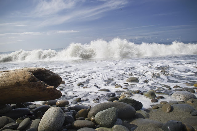
Next, it was Dungeness National Wildlife Refuge, one of the world's longest natural sand spits that has a quiet bay and harbor, gravel beaches, and tide flats. Here wildlife finds food, a place to rest, and protection from winds and pounding surf.  When I arrived, I quickly took the trail to the spit. Most of the spit was closed due to nesting birds in the area and unfortunately, I hit the area at high tide on my visit and I was not able to hike very far. The surf was unbelievable. The pounding of the waves thundered along the beach.

Dungeness National Wildlife Refuge


 I traveled across the northern part of the Olympic NP to La Push. La Push is a small community in the state of Washington. It is located near the town of Forks and houses the Quileute tribe. It is also well known for surfing and whale-watching. It is one of the main settings for the second book of the Twilight and New Moon. I really enjoyed the La Push and Rialto Beach area. I spent a long time strolling the beaches looking at all the logs that have been deposited by the surf along the beach. At La Push, I had a great opportunity to photograph a group of Sea Lions that were fishing near the shore line. This area is very spectacular and I highly recommend a visit if you are in the area.

Sea Lion at La Push
 Later I headed to the Hoh Rainforest. Throughout the winter season, rain falls frequently in the Hoh Rain Forest, contributing to the yearly total of 140 to 170 inches (or 12 to 14 feet!) of precipitation each year. The result is a lush, green canopy of both coniferous and deciduous species. Mosses and ferns that blanket the surfaces add another dimension to the enchantment of the rainforest.

The Hoh Rain Forest is located in the stretch of the Pacific Northwest rainforest which once spanned the Pacific coast from southeastern Alaska to the central coast of California. The Hoh is one of the finest remaining examples of temperate rainforest in the United States and is one of the park's most popular destinations.

The Hoh lies on the west side of Olympic National Park, about a two-hour drive from Port Angeles and under an hour from Forks.


After my visit to the Olympic Peninsula, I took the Washington State Ferry from Bremerton to Seattle. A short 40 minute ferry ride takes you across Puget Sound to the city of Seattle. Here I enjoyed visiting the famous Market and its fabulous foods.

Today, I got ready to travel north into Canadian soil and up to Alaska. I left Seattle early morning and fueled the vehicle and made last minute checks to make sure I was not going to have any issues crossing the US/Canada border. Got rid of all my fruits, nuts etc and anything that could become an issue at the border. I was very concerned about all the stuff I had in the van as I always seem to have the worst luck with inspections at border crossings. This time it was not an issue. I was certain that they would search my vehicle but I crossed without a hitch even though I had 3 boxes labeled Dole Bananas in the back seat. No, bananas in the boxes, but I am glad they did not notice the boxes in the back seat!!


Tuesday, April 17, 2012

Day 3 - Arrived in Bozeman, Montana


Today, I finished Day 3 of the trip across America. So far I have logged 2,039 miles on this journey. Along the way, I made stops in Kansas City; Rapid City & Bozeman, MT. Tomorrow, I will journey into the northern part of Yellowstone National Park. Unfortunately, due to the heavy snows lately, most of the park is closed, so the only way in and out is through the northern entrance to Mammoth Hot Springs. I also tried reaching the Grand Tetons National Park and it was also closed. Bummer!!


I had great weather out of Rapid City and made stops at Badlands N.P., Mt. Rushmore and Crazy Horse Monument. The Crazy Horse Memorial mountain crew uses precision explosive engineering to carefully and safely remove and shape the rock of the mountain. Since the dedication of the face of Crazy Horse in 1998, the work has been focused on blocking out the horse's head. A network of about a dozen benches will be cut out around the horse's head. The benches serve to block out the head to within 20 feet of the final surface of the horse's head, while providing access roads for the heavy equipment used to drill holes for loading explosives and to remove loose rock after each blast. This project has been going on here for over 60 years now. Sculptor Korczak Ziolkowski and Lakota Chief Henry Standing Bear officially started Crazy Horse Memorial June 3, 1948. The Memorial's mission is to honor the culture, tradition and living heritage of North American Indians.

Crazy Horse National Memorial


Mount Rushmore


Another stop on this journey was at Mt. Rushmore. The Mount Rushmore National Memorial is carved into the granite face of Mount Rushmore near Keystone, South Dakota. Mount Rushmore features 60-foot sculptures of the heads of former US Presidents George Washington, Thomas Jefferson, Theodore Roosevelt and Abraham Lincoln.


Badlands National Park 

Another of my stops was  Badlands National Park. People are drawn to the rugged beauty of the Badlands. These striking geologic deposits contain one of the world’s richest fossil beds. Ancient mammals such as the rhino, horse, and saber-toothed cat once roamed here. The park’s 244,000 acres protect an expanse of mixed-grass prairie where bison, bighorn sheep, prairie dogs, and black-footed ferrets live today. The photo below is a combination of 36 individual photographs stitched together to make this image.


Sunday, April 15, 2012

April 15, 2012 - Georgia to Kansas City, MO

Departed Georgia right on time. Left Atlanta about 5am and arrived in St. Louis as scheduled. Been watching all the bad weather and tornadoes in the region and trying hard to avoid the bad storms. As you can see from my high tech setup in the van, I have satellite navigation and live weather on the iPad. Yes, I am a GEEK. This set-up is  was very helpful but we had to face the storm and cut through it. The rain was unbelievable. It was coming down so hard that visibility was less than a car's length. As I expected, it has been very windy since I left Chattanooga which makes driving this vehicle very hard. So far I have 2,666 miles until I reach Seattle. Total distance traveled today was 818 miles.


To the left is the IBM ThinkPad satellite navigation. On the right is the iPad with the weather App I used to try dodge storms.

St. Louis, MO

Gateway Arch in St. Louis, MO
 
This famous monument to westward expansion is composed of a stainless steel arch 630 feet high and 630 feet wide. There is an elevator that travels up the inside of the arch to offer a view out of a small portal at the apex. The $29 million monument was designed by Eero Saarinen, and built in 1965. The Guinness Book lists it as the tallest monument in the world. At the base of the arch, underground, is the Museum of Westward Expansion, with displays and dioramas on that subject, focusing on the Jeffersonian era of exploration and the voyage of Lewis and Clark.

 Yes, I did the touristy thing and took the elevator to the top of the Gateway Arch!


Saturday, April 7, 2012

The Adventure Begins April 15, 2012


“Twenty years from now you will be more disappointed by the things you didn’t do than by the ones you did do. So throw off the bowlines, sail away from the safe harbor. Catch the trade winds in your sails. Explore.  Dream.  Discover.”    – Mark Twain


The Long Way to Alaska

Many visitors fly or cruise to Alaska, but the magic of the north doesn’t begin at the state border. The Canadian provinces of Alberta, British Columbia, and the Yukon offer wildlife, scenery, and history of their own, as do the states of the northern and western United States. Because of this, some people make the excellent choice of reaching Alaska via the Earth’s surface. It can be done by car and Alaska is best appreciated when you sense its remoteness by taking the long road to get there.

For this long road trip, I will be using a newly purchased Ford E-350 Super Duty passenger van. This vehicle will be moved from its current location in Suwanee Georgia to Anchorage Alaska, a distance of over 5,000 miles. The new Ford will join its twin brother in Anchorage and will be put into service in 2012 to take visitors  on some great adventures in Alaska with my company, Planet Earth Adventures.

Planet Earth Adventures Vehicle #2

Preparing for the Long Road Trip

Traveling great distances across multiple US States & Canada, variable terrains and experiencing diverse landscapes is significantly rewarding, however the pre-trip preparation is very important to avoid costly breakdowns, delays and/or re-routing.

The amount vehicle preparation depends on the type of adventure you are about to undertake. The depth of preparation will depend on if you are traveling the highways of USA or tackling the ‘dirt roads’ in Canada & Alaska. During the process it is best to have a hands on approach. I have thoroughly checked every system of the vehicle to make sure that everything is in working order.

For the extreme climate of the north, the Ford got outfitted with a Wolverine battery heater, engine and transmission oil heaters. Because the vehicle is used in many dirt/gravel roads, all the interior door panels and trim have been reinforced to prevent panels from rattling or coming loose on the rough roads. I hate annoying rattles and squeaks!


I have also installed some electronic equipment to help me along the way.  The Ford van is equipped with a VHF Radio for 2-way communication; an Iridium Satellite Phone to connect with the outside world when you are in the middle of nowhere and a GPS Navigation system to help guide the way. For navigation aid, I like to use both a Garmin GPS and an IBM ThinkPad T-40 loaded with GPS Navigation software by Magellan. The advantage of a PC Navigation set-up over a Garmin GPS is that you have the ability to calculate your fuel stops and overnight stops based on data entered into the PC. The PC based navigation system is more flexible in being able to download externally available topographical maps, retain tracks, way points and can co exist with other programs.

Keep up with my progress as I start this adventure on April 15! Subscribe to this Blog below to receive automatic updates or share this on Facebook.


Saturday, January 21, 2012

Great American Road Trip - 2012


The Call of the Road . . .

Entering Alaska at Poker Creek in 2008
Well, new this year is this travel blog and also my plans to take another Great American road trip across the United States. The Call of the Road has hit again. My plans are to start sometime in mid-April. I will be driving a newly purchased Ford E-350 Super Duty van. I am moving this new vehicle to Alaska to use for my tours with my company, Planet Earth Adventures.

My plans are to take the open road again and start in the Southeast, in Suwanee, Georgia and drive northwest through the Central Plains;  the Rocky Mountains and through the Northwest until I reach Seattle. I will then turn North and move into Canada through British Columbia, the Yukon Territory and end in Anchorage, Alaska.

As I have done just over two years ago, this time I will take more time and get to spend some time in some of the most beautiful places in the USA. I plan to re-visit the Badlands, Mt. Rushmore and Yellowstone National Park. Hopefully this time I will be able to see Mount Saint Helen and Mount Rainier. On my last visit to this area, weather was not very cooperating. My goal is to complete this road trip in two weeks.

Follow me on this awesome trip and keep up with my progress along the way. Photos and stories to be posted here on this blog.

Map of this 5,300 mile Journey